Where to Hike in the Rain? Best Trails in Thailand
Gother
23 May 2025


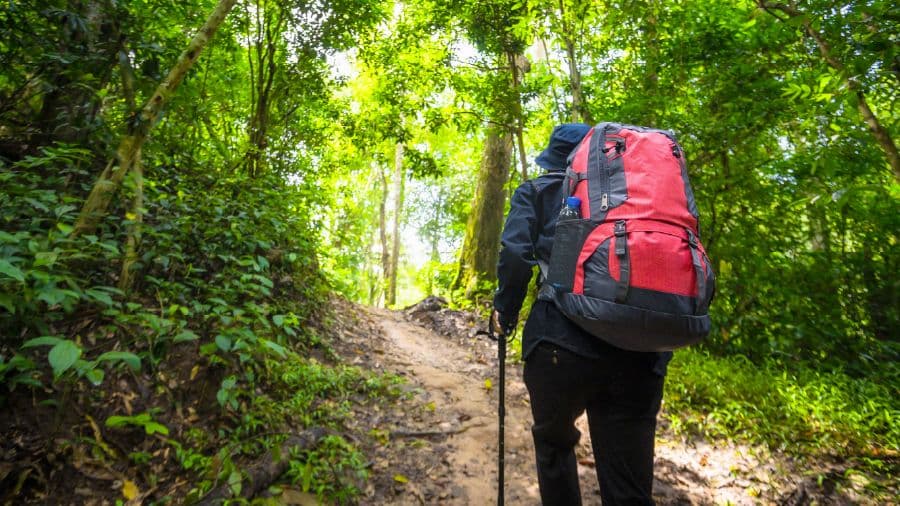
Many people tend to wave goodbye to hiking during the rainy season, often put off by the mud, mess, and perceived difficulty of forest trails. But we’d like to encourage you to see it differently — the rainy season brings nature to life in its most vibrant and lush form. It’s a time when the wilderness hides countless charms waiting to be discovered: misty air, flowing streams, rich greenery, the earthy scent of rain-kissed soil, and the soothing sounds of nature. For those who want to try hiking in the rainy season for the first time, don’t miss this article! Today, Gother is here to share beginner-friendly hiking trails, more adventurous routes for thrill-seekers, and misty mountain treks perfect for fog chasers — plus essential tips for staying safe and having fun while hiking in the rain. Ready? Let’s go! Go Go!!!
Beginner-Friendly Hiking Trails to Explore in the Rainy Season
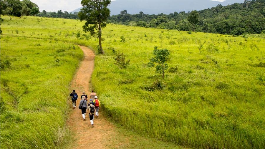
Thailand is home to a wide variety of beautiful hiking trails suitable for all experience levels — from easy routes perfect for beginners to more challenging paths for seasoned hikers. So, if you're a beginner looking to try hiking during the rainy season but aren’t sure where to start, Gother has got you covered! Today, we’re sharing a selection of beginner-friendly rainy season hikes where you can enjoy stunning natural scenery along the way. Ready to explore? Let’s check out some of the top trails.
1. Kong Kaeo Waterfall Trail, Khao Yai National Park
Looking for an easy rainy-season hiking trail for beginners? The Kong Kaeo Nature Trail in Khao Yai National Park is a great choice. This short and scenic loop trail is perfect for first-time hikers. It’s relatively easy to walk, taking about 30–45 minutes to complete the 1.2-kilometer route, including stops for photos and nature observation. No guide is required, and the path is clearly marked. Along the trail, you’ll enjoy a variety of native plant species, including tall trees, undergrowth, and ferns. A highlight of this trail is the suspension bridge that stretches across a stream — a great photo spot. At the end of the trail, you'll reach a small cascading waterfall surrounded by lush greenery, making it an ideal nature walk for a relaxing outdoor experience.
- Pros: Short distance and low difficulty make it suitable for all ages — including children and seniors. The quick walk also allows time for additional sightseeing in the area.
- Cautions: Stick to the designated path, be cautious when crossing the suspension bridge, and watch for slippery surfaces, especially near the waterfall area.
- Starting Point: Suspension bridge behind the Visitor Center
- Ending Point: Same suspension bridge behind the Visitor Center at the park headquarters
- Distance: 1.2 kilometers
- Duration: 30–45 minutes to 1 hour
2. 200th Anniversary Thai–U.S. Friendship Nature Trail, Khao Yai National Park
The 200th Anniversary Thai–U.S. Friendship Trail in Khao Yai National Park is a newly established route created to celebrate the longstanding relationship between Thailand and the United States. In addition to marking the historical ties between the two nations, the trail follows standards and guidance developed by the U.S. National Park Service. Along the way, hikers will experience a rich ecosystem, including dry evergreen forests, secondary forests, and open grasslands. Common wildlife sightings include Siamese fireback pheasants, silver pheasants, gibbons, and hornbills. Please note that this trail requires a park guide to accompany all visitors.
- Pros: Easily accessible and suitable for all experience levels. The trail is relatively short and less crowded as it’s newly opened.
- Cautions: While the trail is easy to follow, some parts may have tree roots, rocky patches, or uneven surfaces. Hikers should proceed with caution.
- Starting Point: Sai Sorn Reservoir Ridge
- Ending Point: Sai Sorn Reservoir Tail End
- Distance: 2 kilometers (loop trail that circles back to the starting point)
- Duration: Approximately 1.5 hours
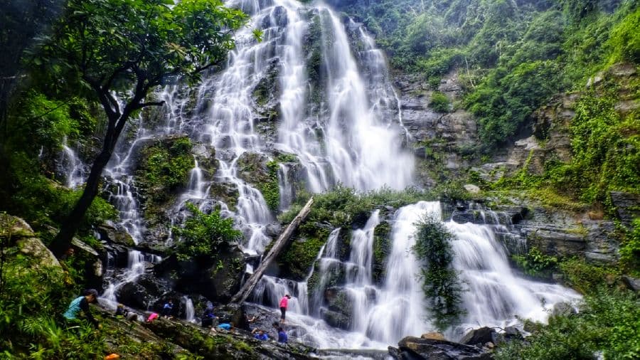
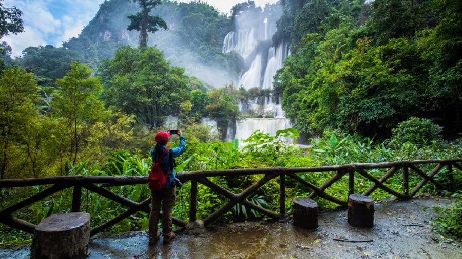
3. Erawan Waterfall Trail, Erawan National Park
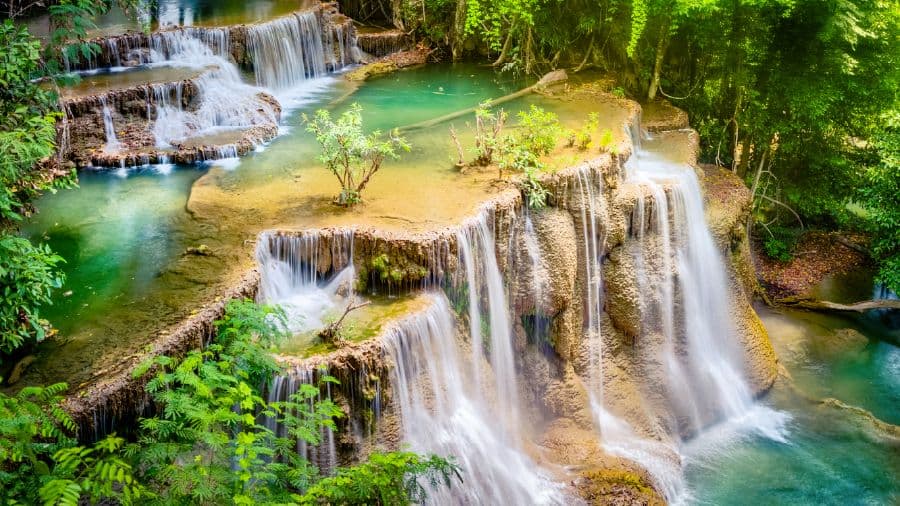
If you're a beginner looking to experience hiking during the rainy season, the Erawan Waterfall Trail in Erawan National Park, Kanchanaburi, is a fantastic choice. This is one of Thailand’s most famous and majestic waterfalls, attracting both local and international tourists. The trail spans approximately 2,200 meters and features seven distinct tiers, each with its own unique beauty and charm. The names of the tiers are as follows: Tier 1 – “Hua Hin Rong Rung” (Flowing Back Home), Tier 2 – “Wang Matcha” (Fish Pool), Tier 3 – “Pha Nam Tok” (Waterfall Cliff), Tier 4 – “Ok Nang Pee Seua” (Butterfly’s Chest), Tier 5 – “Buea Mai Long” (Never Bored), Tier 6 – “Dong Phueksa” (Flora Grove), and Tier 7 – “Phu Pha Erawan” (Erawan Cliff). The final tier is particularly special — during heavy flow, the water cascades down in a formation resembling a three-headed elephant, or “Erawan,” which is where the national park gets its name. Along the way, hikers can cool off and swim at certain tiers to rest and refresh.
- Pros: Each tier of Erawan Waterfall offers a different view and experience, with vibrant colors and unique rock formations.
- Cautions: Be cautious of slippery surfaces, especially near the waterfalls. Walk carefully to ensure safety.
- Starting Point: Visitor Center to Tier 1 “Hua Hin Rong Rung”
- Ending Point: Tier 7 “Phu Pha Erawan”
- Distance: 1.5 kilometers
- Duration: Approximately 2 hours
4. Phu Soi Dao Hiking Trail, Uttaradit
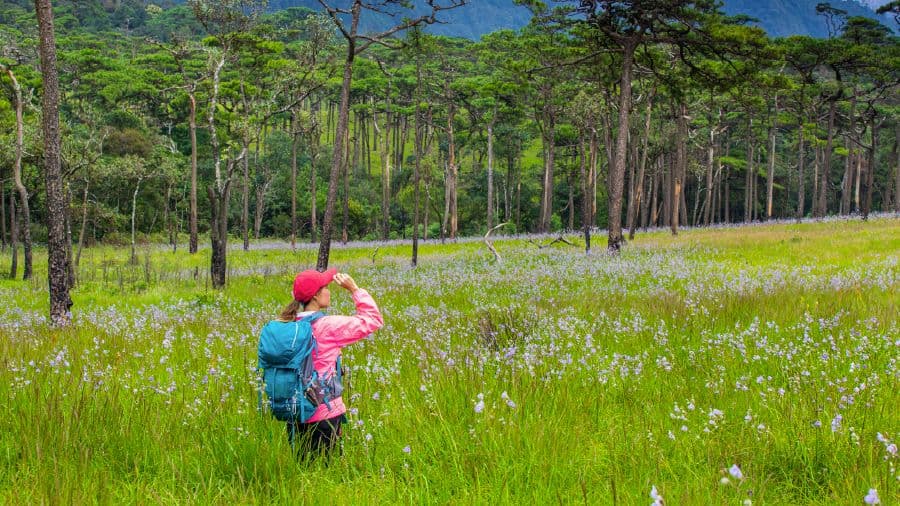
When it comes to rainy season hiking destinations in Thailand, Phu Soi Dao is always at the top of the list for many avid hikers. This is the most beautiful time to visit the area, thanks to the seasonal blooming of the “Naka crest flowers” (Murdannia giganteum), which transform the pine forest meadow into the largest wildflower field of its kind in Thailand. These purple-blue flowers bloom alongside other species like the golden-hued “Soi Suwannaa” and the fragrant “Rak Hom” grass, all set against a misty backdrop and cool mountain air. The trail features a variety of landscapes — from hills and pine forests to flower fields — and includes five main slopes: "Goodbye Hill", "Challenge Hill", "Bamboo Hill", "Tiger Hill", and the intimidatingly named "Death Hill." While the hike isn't extremely technical and is accessible for beginners, it does require endurance due to the length and steady incline.
- Pros: You’ll experience the breathtaking beauty of wildflower meadows in full bloom, including Naka crest flowers, Soi Suwannaa, and more — especially vivid during the rainy season.
- Cautions: The trail to Phu Soi Dao is steep and involves a long-distance hike. Proper physical preparation is essential.
- Starting Point: Phu Soi Dao National Park Headquarters
- Ending Point: Phu Soi Dao Pine Meadow
- Distance: 6.5 kilometers
- Duration: Approximately 6 hours
5. Phu Wua Hiking Trail, Bueng Kan
This rainy season, why not change up the scenery and head to Northeastern Thailand? Explore the lush trails of Phu Wua National Park in Bueng Kan — an Unseen Paradise of Isaan. Known for its dense tropical rainforest, majestic waterfalls, steep cliffs, and mysterious caves, this park offers a rewarding hiking experience. The Phu Wua hiking trail is particularly famous for its large and scenic waterfalls. During the rainy season, the forest comes alive with wildflowers that bloom only at this time of year. A highlight of this trail is the natural jungle jacuzzi — a spot where you can relax in fresh flowing water surrounded by untouched wilderness.
- Pros: Experience lush greenery, biodiversity, and the tranquility of the rainforest, along with impressive waterfalls.
- Cautions: The trail can be hot and slippery, so hikers should proceed with caution and wear proper gear.
- Starting Point: Phu Wua Ranger Station (PWO.1) – Chan Naen Waterfall
- Ending Point: Depends on your chosen route: Chan Naen Waterfall, Chet Si Waterfall, Tam Fun Waterfall, or other viewpoints
- Distance: Chan Naen Waterfall Trail: 2–3 km / Chet Si Waterfall Trail (from Phu Wua Reservoir): 5–7 km / Tam Fun Waterfall Trail (from Phu Wua Reservoir): 8–10 km
- Duration: 1.5–3 hours / 3–5 hours / 5–7 hours (depending on the route)
Moderately Challenging Hiking Trails for Adventurous Trekkers
Level up your rainy season hiking experience with a bit more challenge! For adventurous nature lovers who enjoy pushing their limits, we’ve gathered a list of moderately challenging hiking trails that are perfect for those looking to take on a true forest adventure — at least once in a lifetime. So, get ready, pack your gear, and let’s hit the trails!
6. Phu Kradueng National Park Hiking Trail, Loei Province
Phu Kradueng is one of the most iconic hiking trails in Thailand — a bucket-list destination for many beginner trekkers looking to conquer a serious challenge. While it combines both easy and difficult sections, we’ve placed it among the more adventurous trails for thrill-seekers. If you love forest trekking, this is one trail you can’t miss. As the saying goes, “If you want to prove true love, hike up Phu Kradueng together.” The trek to the summit is about 9 kilometers long and is divided into distinct segments: “Sam Haek” is a steep uphill climb, followed by “Sam Bon,” a mix of slopes and flat sections. Then comes “Sam Kok Kok,” a mildly undulating route, and “Sam Moey,” a blend of flat terrain and gentle climbs. After that, you'll reach “Lang Pae,” one of the steepest parts of the hike, before arriving at the flat plateau of “Wang Kwang.” It’s definitely exhausting — but luckily, porter services are available to carry your bags if needed!
- Pros: Stunning scenic views and a great test of endurance and physical strength
- Cautions: Allow plenty of time for the hike. It becomes difficult and dangerous if it gets dark before you reach the top.
- Starting Point: Visitor Center area
- Ending Point: Summit Plateau (Wang Kwang)
- Distance: 9 kilometers
- Duration: 4.5–7 hours (ascent only)
7. Sai Rung La-ong Dao Hiking Trail, Ranong Province
One of the most popular rainy season hiking trails in Thailand is the Sai Rung La-ong Dao Trail in Ranong province. This trail offers the full range of adventure — from river trekking and jungle hiking to sleeping in hammocks beside streams and soaking in natural pools. Hikers will face leeches, steep mountain climbs, and strong river currents, with some water crossings reaching waist-deep levels. The round-trip trail spans more than 16 kilometers and is physically demanding, requiring both strength and survival skills. The reward at the end? A hidden waterfall deep in the forest, often shrouded in mist and fine spray that sparkles like a rainbow — truly living up to its name. This trail is not just a physical test but a mental and emotional journey, making it one of the most extreme and rewarding hikes in the country. Those who dare to try should be in excellent physical condition for a safe and fulfilling experience.
- Pros: A true test of strength and self-reliance, offering real-world survival challenges you won’t find in any textbook
- Cautions: The trail can be slippery and muddy, with the possibility of encountering wildlife or insects — caution is essential
- Starting Point: Lam Nam Kra Buri National Park Ranger Station
- Ending Point: Sai Rung La-ong Dao Waterfall
- Distance: 16 kilometers (round trip)
- Duration: Requires overnight camping in the forest
8. Doi Luang Chiang Dao Hiking Trail, Chiang Mai Province
If you're a nature lover with a passion for hiking, climbing, and embracing challenges, then Doi Luang Chiang Dao in Chiang Mai is a must-visit destination. This mountain is on the bucket list of many trekkers and adventurers, being the third-highest peak in Thailand. With its stunning panoramic views and captivating natural surroundings, Doi Luang Chiang Dao offers an unforgettable hiking experience. The trail is considered moderate to difficult, with steep inclines and some sections requiring climbing, making strong legs and determination essential. There are currently two main routes: Pang Wua – Ang Salung (approximately 6.5 km), which features multiple steep sections requiring caution, and Den Ya Khat – Ang Salung (approximately 8.5 km), the most popular route due to its diverse forest landscape and well-equipped campsites. Choose the route that matches your adventure level and prepare for a remarkable journey.
- Pros: Witness breathtaking morning mist, rare wildflowers, and panoramic views of layered mountain ranges
- Cautions: Be aware of possible wildlife encounters, and ensure you're in good physical condition before attempting the hike
- Starting Point: Khun Huai Mae Kok Ranger Station or Mae Mae Watershed Management Unit
- Ending Point: Summit of Doi Luang Chiang Dao
- Distance: 14–16 km via Khun Huai Mae Kok route / 18–20 km via Mae Mae route
- Duration: Requires overnight camping in the forest
9. Pitu Kro Waterfall to Thi Lo Su Trail, Tak Province
The Pitu Kro – Thi Lo Su Waterfall trail in Tak Province is a true test of endurance — both for your legs and your spirit. This demanding trail takes you through humid, muddy, and slippery terrain, especially during the rainy season when heavy downpours can turn paths into rivers of mud. At certain points, you’ll even need to cross strong-flowing streams to reach the waterfalls. Located within the Umphang Wildlife Sanctuary near Doi Mamuang Sam Muen and the Thai–Myanmar border, this area is a hidden gem in the deep forest. The highlight of the trek is the magnificent Pitu Kro Waterfall, shaped like a heart and surrounded by pristine nature. During the rainy season, it becomes even more spectacular as water gushes powerfully from springs atop the mountain. The journey here is as challenging as it is rewarding — you’ll need to endure over 1,219 curves by car before hiking 5 kilometers through dense jungle, steep cliffs, and wild terrain. This trail isn’t for the faint of heart — but it’s one you’ll never forget.
- Pros: Marvel at the beauty of Pitu Kro Waterfall and the majestic Thi Lo Su Waterfall
- Cautions: Study the trail in advance, bring all essential gear, and prepare your body for tough conditions
- Starting Point: Near Umphang Village
- Ending Point: Thi Lo Su Waterfall inside Mae Wong National Park
- Distance: Divided into two segments — Segment 1 (Pitu Kro): approx. 8–12 km / Segment 2 (Thi Lo Su): approx. 1–2 km
- Duration: 2 days 1 night or 3 days 2 nights
10. Lam Khlong Ngu Hiking Trail, Kanchanaburi Province
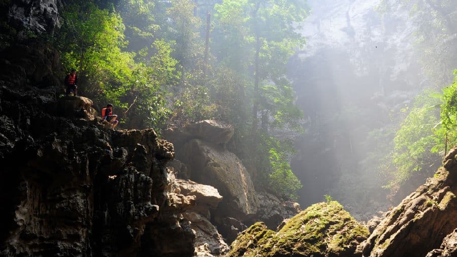
If you're an adventure lover who enjoys thrilling and challenging treks, pack your bag and head out for a rainy season jungle hike at Lam Khlong Ngu National Park in Kanchanaburi. This destination is perfect for nature enthusiasts, explorers, and those who love discovering Thailand’s hidden gems. Located in the western section of the Thung Yai Naresuan Wildlife Sanctuary, Lam Khlong Ngu is one of the country's most famous and adventurous trekking spots. The hike combines riverside trekking and rafting by inflatable raft or kayak. A major highlight of this route is exploring Sao Hin Cave — a massive cavern filled with towering limestone columns and spectacular stalactites and stalagmites. The full Lam Khlong Ngu experience is divided into three parts: first, hiking along the riverbank; second, rafting down the stream; and third, exploring the cave. Expect a variety of terrain, including jungle paths, boulders to climb, and fast-moving waters to navigate. This is one of Thailand’s most action-packed hikes, requiring stamina, strength, and an adventurous spirit!
- Pros: You’ll get to hike, raft, and explore a cave — all in one trip! A truly rewarding and complete adventure experience.
- Cautions: Watch out for wildlife and venomous insects. Be sure to prepare physically and bring necessary gear.
- Starting Point: Forest protection unit or checkpoint designated by park rangers
- Ending Point: Same as the starting point (loop trail)
- Distance: 10–15 kilometers (round-trip loop)
- Duration: 1 day, or overnight if extended
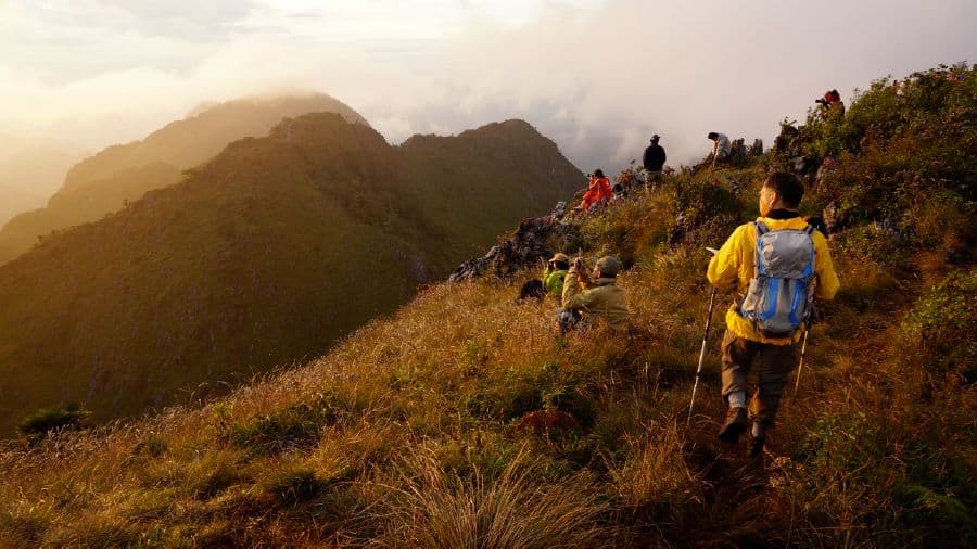
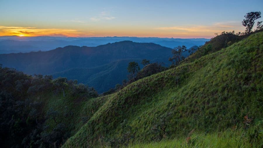
Rainy Season Hiking Trails with Sea of Mist Views and Refreshing Cool Air
Hiking to see the sea of mist during the rainy season is a unique and enchanting experience that differs from trekking in other seasons. While rainy season hikes come with challenges like rain and humidity, they also reward you with vibrant green forests and stunning post-rain mist. The sight of the mist rolling over mountain ridges after a long hike makes every step worth it. In this article, Gother is here to share three scenic rainy-season hiking trails where you can witness breathtaking sea of mist views — perfect for nature lovers seeking serenity and adventure.
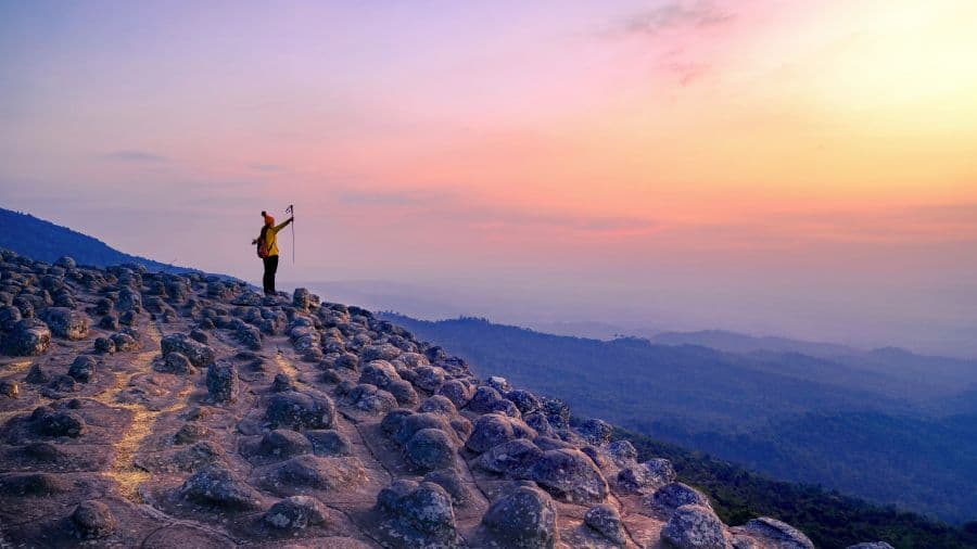
11. Doi Wa Wajo Hiking Trail, Mae Hong Son Province
Doi Wa Wajo, located in Mae Sariang District, Mae Hong Son Province, is a fantastic choice for rainy season hiking. This trail hides within it the raw beauty of northern Thailand’s wilderness. Hiking up to Doi Wa Wajo is a true adventure, combining both scenic serenity and physical challenge. The trail follows a ridgeline path, similar to the famous Khao Chang Phueak, with alternating ascents and descents. Most of the trail is steep — especially the final section near the summit, which demands strong legs and stamina. Despite the effort, hikers are rewarded with spectacular sights along the way: wild northern flowers, panoramic ridgeline views, and seas of mist blanketing the mountains — an awe-inspiring landscape in every direction.
- Pros: Witness stunning morning mist, sweeping views of layered mountain ranges, and pristine natural surroundings
- Cautions: It’s recommended to hike in a group with an experienced local guide for safety
- Starting Point: Lahu village in Mae Sariang District
- Ending Point: Summit of Doi Wa Wajo
- Distance: 10–15 kilometers
- Duration: Full day or 2 days and 1 night
12. Phu Hin Rong Kla National Park Hiking Trail, Phitsanulok Province
สายรักธรรมชาติชื่นชอบการเดินป่าเป็นชีวิตจิตใจ ต้องไม่ควรพลาดกับการมาเดินป่ากันที่ อุทยานแห่งชาติภูหินร่องกล้า จังหวัดพิษณุโลก ที่ได้สัมผัสกับทะเลหมอกที่ปกคลุมยอดเขา สูดอากาศบริสุทธิ์ และได้สัมผัสอากาศเย็นสบาย สำหรับการเดินทางไปเที่ยวอุทยานแห่งชาติภูหินร่องกล้านั้น สามารถเลือกใช้เส้นทางได้หลายทาง ได้แก่ เส้นทางที่ 1 จากอำเภอนครไทย - อุทยานแห่งชาติภูหินร่องกล้า เส้นทางที่ 2 จากอำเภอด่านซ้าย - เส้นทางอำเภอนครไทย - อุทยานแห่งชาติภูหินร่องกล้า และเส้นทางที่ 3 จากจังหวัดเพชรบูรณ์ - บ้านน้ำก้อ - ภูทับเบิก – อุทยานแห่งชาติภูหินร่องกล้า ถ้าใครเพิ่งเคยเดินป่าครั้งแรก แนะนำให้ขึ้น-ลงทางอำเภอนครไทย จังหวัดพิษณุโลก เพราะด้านอำเภอหล่มเก่า ทางขึ้นเขาค่อนข้างชันไม่เหมาะกับคนที่มีประสบการณ์น้อยในการขับรถขึ้น-ลงเขา ใครอยากจะหาที่เที่ยวเดินป่าชมธรรมชาติและประวัติศาสตร์ ลองไปอุทยานแห่งชาติภูหินร่องกล้า น่าจะถูกใจสายเที่ยวครบจบทั้งลุยและสายชิลล์
- ข้อดี: สูดอากาศบริสุทธิ์ภายใต้ร่มเงาของป่าสน ชมวิวทิวทัศน์ของเทือกเขา และชมน้ำตกที่สวยงาม
- ข้อควรระวัง: ด้วยเส้นทางที่อาจจะมีความชันเยอะพอสมควร จึงควรเตรียมร่างกายให้พร้อมลุย
- จุดเริ่มต้น: บริเวณศูนย์บริการนักท่องเที่ยว หรือ บริเวณใกล้เคียงที่ทำการอุทยานฯ
- จุดสิ้นสุด: ขึ้นอยู่กับเส้นทางที่เลือก เช่น ผาชูธง, ภราดร
- ระยะทาง: 1.2 กิโลเมตร และมีเส้นทางเดินทางเดียว วนกลับมาที่เดิม
- ระยะเวลา: เส้นทางศึกษาธรรมชาติลานหินแตก - ผาชูธง ระยะทางประมาณ 4-5 กิโลเมตร / เส้นทางเดินป่าสู่น้ำตกร่มเกล้า-ภราดร ระยะทางประมาณ 6-8 กิโลเมตร
13. เส้นทางเดินป่า ดอยหลวงตาก จังหวัดตาก
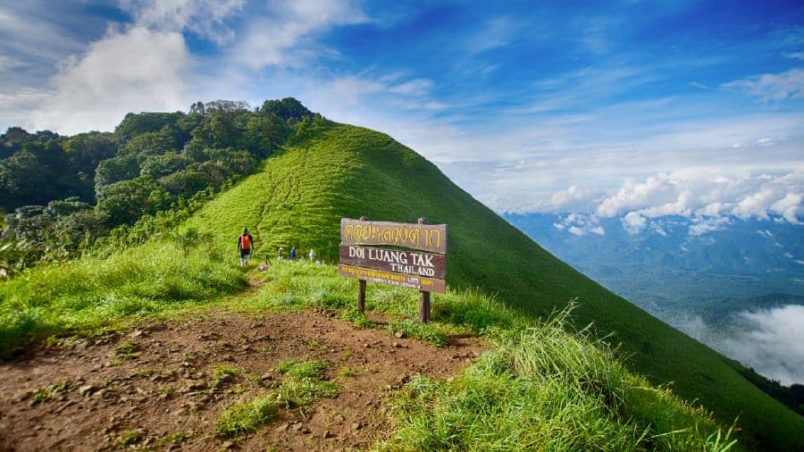
Doi Luang Tak, located in the Doi Soi Malai–Petrified Forest National Park, is an excellent destination for nature lovers — especially those who enjoy forest trekking. The full round-trip hiking trail covers a distance of approximately 22 kilometers.
The trail features a mix of flat terrain and moderate to steep slopes, including streamside paths and rocky climbs. It’s beginner-friendly and accessible year-round. In the early mornings, the trail is often blanketed with gentle mist and cooled by fresh, crisp air. Along the route, hikers will encounter a variety of landscapes — from streams and open forests to pine woods, grasslands, cliffs, and humid banana groves. You can opt for a day trip or an overnight trek with camping to catch a stunning sunrise and sea of mist from the summit. Note that the trail is only open on weekends and public holidays, and hikers must be accompanied by park rangers.
- Pros: Breathtaking panoramic views of rolling mountain ranges and expansive forests from the summit viewpoints
- Cautions: Some sections are quite steep and can be challenging — physical preparation is recommended
- Starting Point: Forest ranger station
- Ending Point: Depends on the chosen route, such as Pha Daeng Waterfall or the summit of Doi Luang Tak
- Distance: 1.2 kilometers for short routes; main trails include the Pha Daeng Waterfall Nature Trail (approx. 4–6 km) and the summit trail (approx. 8–12 km)
- Duration: Half-day to full-day hike; overnight camping possible
Rainy Season Hiking Tips: How to Stay Safe and Ready
The rainy season is a popular time for nature lovers to go hiking and explore the outdoors, as it offers lush landscapes and blooming flora. However, hiking during this season also comes with its own set of risks, so proper preparation is essential. In addition to getting physically fit for the trek, it’s important to bring the right gear — including lightweight and quick-dry clothing, sturdy shoes, a hat, a raincoat or umbrella, plastic bags, a flashlight, medication, a first-aid kit, leech socks or repellents, and a power bank. If your trip includes an overnight stay, don’t forget a tent and sleeping bag.
So, what do you think of these 13 rainy season hiking trails we’ve curated for you? From beginner-friendly forest walks to more challenging mountain climbs, there’s something for everyone. If you’re eager to reconnect with nature and breathe in that fresh, rain-washed forest air, pick one of the routes we’ve recommended and start planning your adventure! Just remember to gear up properly and stay extra cautious — safety comes first. Once you’ve recharged your soul in the forest, Gother also offers plenty of other exciting adventure activities like white-water rafting, surfing, paramotoring, scuba diving, and more. Plus, you can find a wide range of accommodations across Thailand at special prices — so you can save more and keep the fun going!